New Development in Alpine and the Questions It Brings
A large section of land along N 16th St has been purchased near the Alpine Middle School, bringing questions from the neighborhood.
The property in the image below, along N 16th St near the middle school, was recently purchased. Nearby property owners attended the last council meeting, on January 7th, asking questions about possible development. The new owner discussed their proposed plans which I’ll go into more detail further below.
A Wrinkle in the Plan - City Owned Streets
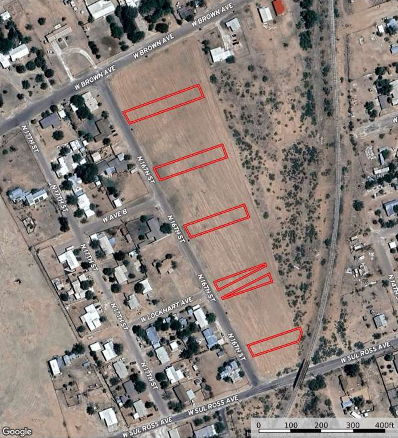
After buying the property, the owner was made aware of city owned sections that were planned streets in case of development. The sections are listed in red below.
The top three avenues in red are Saltillo, Monterey, and Toluco. Below is a 25’ alleyway on Avenue C - across from Lockhart Ave. The lowest road is Morilos Ave. An appraisal was done and the owner is offering $30,000 for the city owned property, not to include the 25’ alleyway. This would give them the flexibility to replat the property into parcels that are easier to resell or develop.
So What’s the Proposed Plans for the Property?
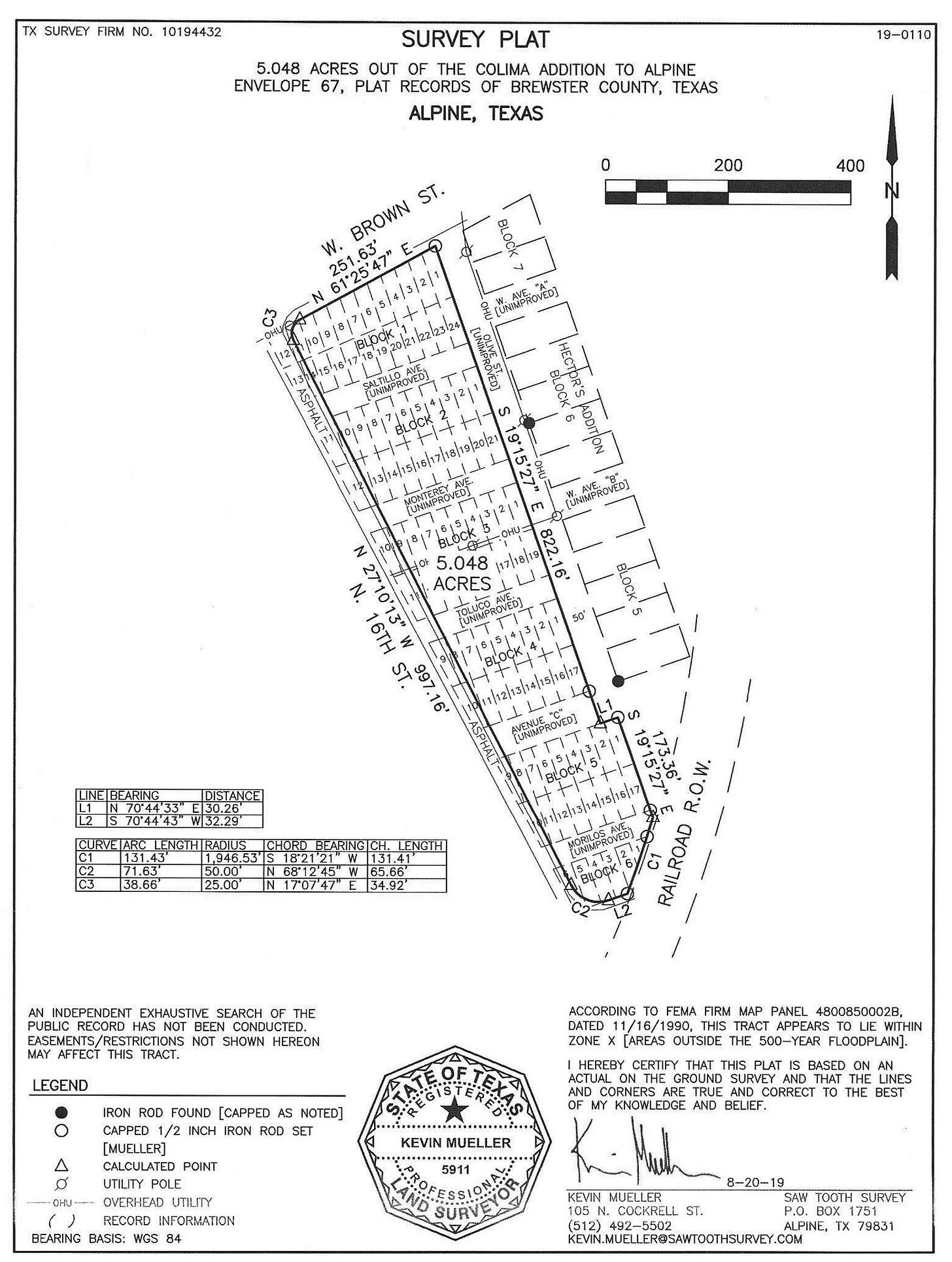
This leads into the little we know of how this property may be developed. The current property survey plat is composed of very small parcels, possibly for manufactured homes. You can see this in the image below.
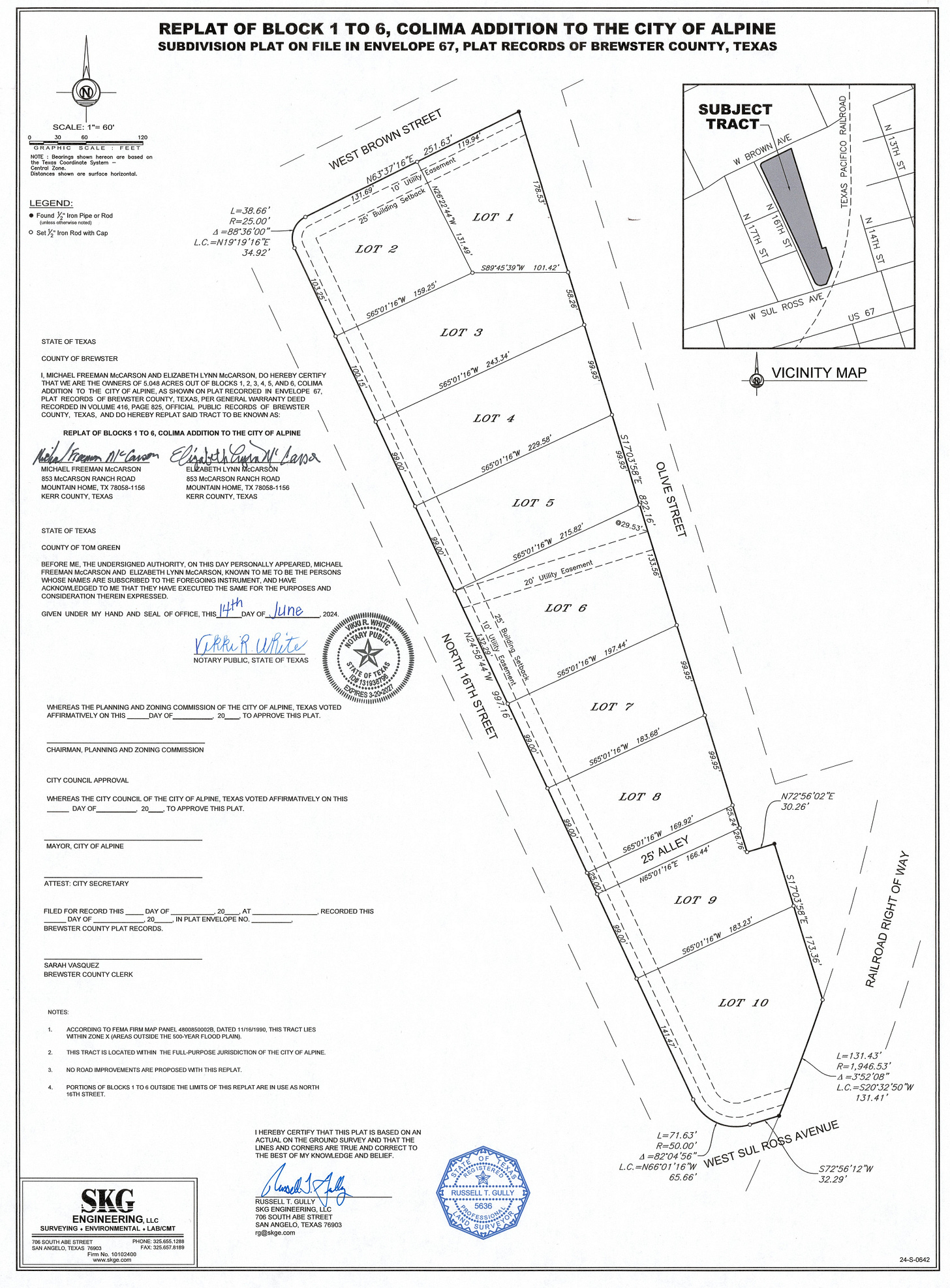
The owner has shared their plans to replat this property into ten larger parcels. A survey plat showing the planned changes is below.
Procedural note: The planned plat was denied as the owner does not currently own the aforementioned city streets within the property. They are required to buy the city owned land before moving forward. The city council accepted the first of two readings to accept this offer on January 7th. It would be finalized by council at the January 21st meeting, if accepted.
It’s important to note that if the city owned property is sold, the property owner can do anything they choose moving forward - as long as allowed within law and the current zoning designation of R2 - Multi-family District. The city of Alpine defines an R2 district as below.
This zone is intended to provide for medium density living, for example, with not more than one (two bedroom) dwelling unit permitted for each 3,500 square feet of lot area. (See Site Development Regulations). Additional uses necessary and incidental to multiple family residential dwellings are also permitted.
Principal permitted uses: Duplex, Local utility service, Group Residential*, R-1 single-family residential, Townhouses
The Good, the Bad, and the Ugly
Any development will bring change; both good and bad. I believe Alpine should embrace change, but with lots of public feedback and transparency.
So What are Possible Benefits?
City streets are for building community wealth. This is done through increasing land values and thus property taxes, which are then reinvested in community needs. In other words, city funds pave streets, pay police, and provide parks.
If we look at this section of N 16th St using the most recent Brewster County Appraisal District values, each side of the street tells a different story. The undeveloped side of the street currently brings in the below revenue.
$1,021.95 in total tax revenue (City, School District, County, Hospital). This includes current tax exemptions so it is actual revenue.
Of that, $245.95 is tax revenue for the City of Alpine. This includes current tax exemptions so it is actual revenue.
The side that is developed with homes brings in the below revenue. I added bullets that show the theoretical revenue with no tax exemptions, as well as actual revenue with current exemptions, and actual revenue that Alpine receives.
$20,359.12 in theoretical tax revenue (City, School District, County, Hospital). This does not include tax exemptions so it is only theoretical.
$10,180.91 in actual tax revenue (City, School District, County, Hospital). This includes current tax exemptions so it is actual revenue.
Of that, $3,510.07 is tax revenue for the City of Alpine. This includes current tax exemptions so it is actual revenue.
One side of this street is paying $3,510 annually in taxes; supporting paving, police, and parks. The other side pays $245 annually. Through development the city will bring in more revenue as well as providing more revenue to the county, hospital, and school district.
Other benefits include increasing housing supply and bringing in new people who may volunteer, open new businesses, or shop at local businesses.
What are the Possible Negative Considerations?
As mentioned during public comment at the January 7th council meeting, traffic and crime may increase - though I feel we live in a very low crime and traffic area. Infrastructure would also need to be added, though the city is working hard to find funding dedicated towards water and wastewater. These issues are not specific to N 16th St.
Opinion: I feel a primary worry of most property owners is if a development will lower their property value. In America, housing is an investment as well as shelter. Because of this, neighborhoods are open to development that increase home values, but worry about smaller or more affordable home footprints.
The Ugly - What About Planning and Design?
My concern with this development is in it’s planning and design. We have seen a replat survey which will split the 5.8 acre property into ten large parcels. If those parcels are sold, owners can build anything legal in an R2 zone - such as duplexes, group residential, or townhouses. I’m not against any of these designs as they could increase density and lower housing costs. I worry about not properly planning for these items from the start. Some questions I have are below.
Will Olive St (the unimproved road behind this property) be developed in the future? If so, how and by whom?
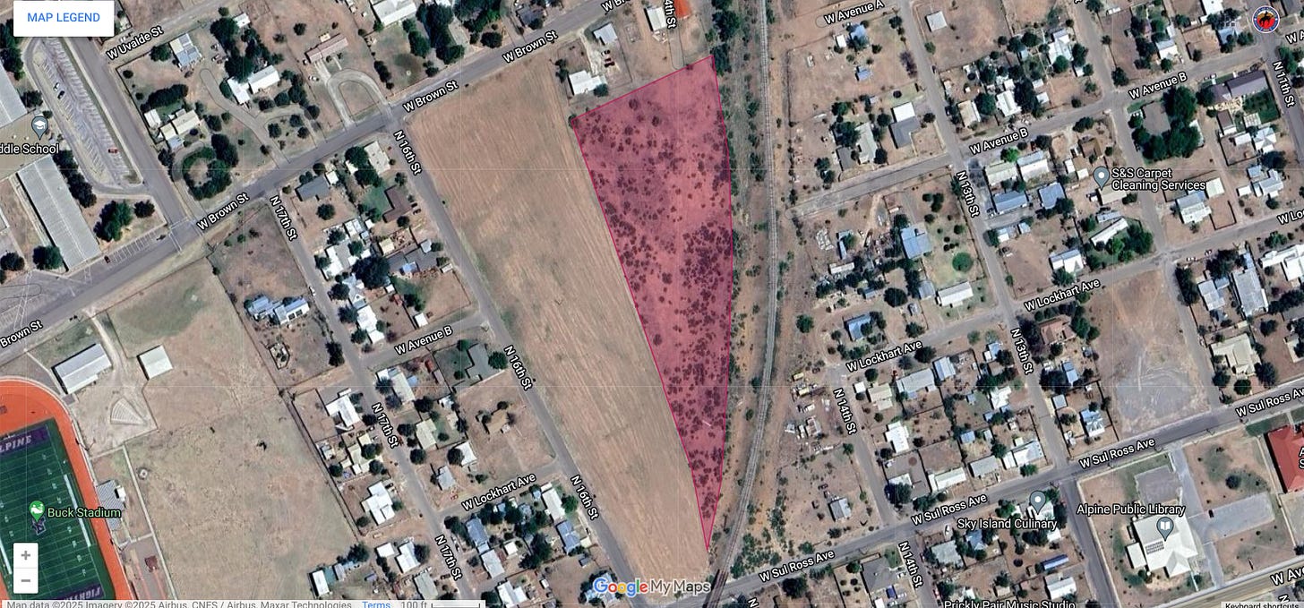
Will this development block off interest in parcels east of Olive St, abutting the railroad right-of-way - image is below.
Are two entrances needed to get to Olive St for safety reasons?
Will the 25’ alley the city is keeping, across from Lockhart Ave, become a street or be used as an alley?
Once the currently owned city streets, described above in the article, are sold to the property owner, the city loses leverage in working with the developer. The developer can always change plans after purchasing the property, but it should be the city’s intention to activate this property via planning from the start.


I wonder if the McCarsons would be interested in coming to the summit this weekend!
https://www.alpinecommunityprojects.org/january-2025-summit